
Wind Resource Assessment in Saudi Arabia: Predictive Engineering for National Energy Security
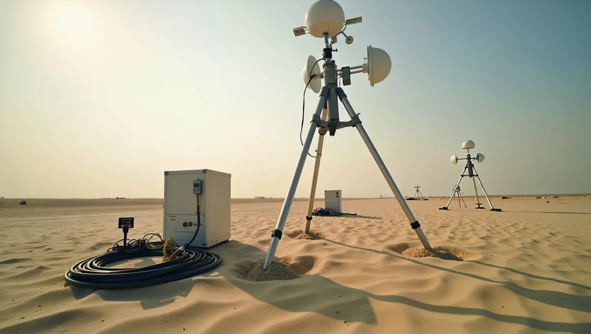
A robust energy strategy for the Kingdom of Saudi Arabia requires validating every potential resource to meet the ambitions set by Vision 2030. Wind power represents a critical pillar in diversifying the national energy matrix, complementing solar and geothermal assets. However, determining this wind potential is not merely measuring average speed; it involves executing a complex engineering exercise known as Wind Resource Assessment (WRA). This process determines the long-term, statistically reliable mechanical power available at specific geographic coordinates across Saudi Arabia.
For engineers tasked with validating large-scale renewable energy investments across KSA's vast and diverse topography—from the arid interior plateaus near Riyadh to the dynamic coastlines of the Red Sea and Arabian Gulf (including industrial hubs like Jubail and KAEC)—the accuracy of the WRA is non-negotiable. Miscalculating resource potential can result in significant over- or under-sizing of generation assets, leading to financial instability and grid integration challenges with local grid operators. We approach this assessment not as an estimate, but as a rigorous scientific validation.
Understanding Wind Resource Assessment: The Feasibility Foundation
Wind Resource Assessment (WRA) is the systematic methodology used to characterize the spatial and temporal variability of wind speed and direction at a prospective generation site. It moves beyond basic measurements by establishing statistical models that predict energy output over decades, mitigating the inherent uncertainty associated with atmospheric dynamics.
At its core, WRA addresses three primary questions: What is the average wind speed? How consistently does that speed persist throughout the year (seasonality)? And critically, what are the turbulent characteristics of the flow?
Feasibility studies hinge on establishing a credible baseline. The assessment must quantify parameters such as mean annual wind speed at hub height, the frequency distribution of speeds (e.g., Weibull and Rayleigh distributions), and crucial metrics like shear exponent and turbulence intensity. These statistical outputs directly inform preliminary turbine selection and the calculation of theoretical capacity factors.
The complexity of the Gulf environment necessitates specialized consideration. Wind patterns in KSA are influenced by mesoscale meteorological phenomena, such as seasonal shifts in pressure gradients between continental interiors and maritime regions like those near Jeddah or the Eastern Province. Furthermore, the assessment must account for localized effects like topographical channeling (e.g., wind accelerating through narrow coastal passes) and atmospheric boundary layer stability.
Advanced Methodologies: Tools and Data Streams for Accurate Modeling
Achieving high confidence in predicted energy yield requires integrating multiple, often disparate, data streams into advanced computational models. No single measurement tool provides the necessary comprehensive picture; rather, it is the convergence of historical records, atmospheric science, and direct field measurements that yields actionable results.
Meteorological Data Analysis
The initial phase involves analyzing decades of gridded meteorological data (e.g., reanalysis datasets). These global models provide a broad context, establishing baseline trends for wind speed, temperature, and pressure across the region. This historical dataset helps identify seasonal cycles and long-term climate variability.
Computational Fluid Dynamics (CFD) Modeling
For site-specific validation, CFD modeling is indispensable. CFD simulates the physical movement of air mass over a defined terrain model. It allows engineers to predict how local features—such as changes in roughness length, or even the urban heat islands created by rapid expansion in cities like Riyadh—will modify incoming wind flow. This analysis is crucial for identifying areas where natural obstacles might create detrimental wake effects or conversely, accelerate desirable airflow.
On-Site Measurements and Instrumentation
The gold standard remains direct measurement. A multi-year monitoring campaign utilizing meteorological masts (metmasts) equipped with class-grade anemometers and sonic sensors is required. These instruments must be deployed at representative hub heights (e.g., 80 meters or 120 meters). The deployment duration—ideally three consecutive years—is necessary to capture the full spectrum of atmospheric variability, including extreme weather events and low-frequency seasonal changes.
The data acquisition system must record wind speed vector components (U, V, W) and ambient temperature with high temporal resolution. This continuous stream of data allows for precise calculation of turbulence intensity and spectral density, parameters that directly influence turbine fatigue loading and power curve accuracy.
Site Selection Criteria: Identifying Optimal Wind Corridors in Saudi Arabia
Identifying an optimal wind corridor requires balancing high resource potential with operational feasibility. The ideal site must maximize the capacity factor while minimizing environmental and logistical constraints, especially given the challenges of deploying infrastructure across remote areas.
Key Wind Quality Metrics
Engineers prioritize sites exhibiting consistent, stable mean wind speeds. Key performance indicators include:
- Directionality Consistency: Narrow directional spread (e.g., predominantly from the southwest or northeast) simplifies turbine layout and maximizes energy capture.
- Low Turbulence Intensity (TI): Excessive TI causes rapid fluctuations in aerodynamic load, increasing structural fatigue on the rotor blades and gearbox. Optimal sites maintain a TI below critical thresholds (often < 10-12%).
- High Shear Exponent: A stable power profile across different heights minimizes energy loss due to wind shear—the change in wind speed with altitude.
Addressing Gulf Climate Specific Challenges
The environment itself imposes unique engineering challenges that must be modeled, including haboob storms, saline coastal air, and extreme thermal swings:
- Dust and Particulate Interference: KSA experiences significant aeolian dust deposition. High levels of suspended particulate matter (PM) from fine desert sand can impact monitoring sensors, degrade turbine components, and necessitate specialized protective measures. The WRA must incorporate predictive models for localized dust load accumulation rates.
- Thermal Gradients: Large temperature swings between day/night cycles or coastal/inland zones create atmospheric instability (thermal plumes). These gradients can induce unpredictable wind shear and affect power electronics efficiency within the electrical infrastructure.
- Remote Logistics: Many high-potential corridors are remote, characterized by difficult terrain. The assessment must therefore include an evaluation of logistical risk factors alongside aerodynamic potential.
Comparison of Assessment Tools
The selection of the appropriate modeling tool depends on the desired level of detail and the available input data.
| Methodology | Input Data Required | Spatial Resolution | Primary Output Metric | Best Use Case |
|---|---|---|---|---|
| Historical Reanalysis | Global/Regional Climate Models (ERA5) | Low to Medium (Grid-based) | Long-term statistical trends, Mean Speed | Initial Screening & Global Feasibility |
| Computational Fluid Dynamics (CFD) | High-resolution Digital Elevation Models (DEM), Roughness Length | Medium to High (Site-specific grid) | Flow modification, Wake effects, Turbulence Intensity | Optimizing Farm Layout & Local Effects |
| On-Site Monitoring (Metmasts) | Sonic Anemometers, Temperature Sensors | Very High (Point measurement) | Weibull parameters, Capacity Factor, Power Curve Validation | Final Project Verification & Investment Decision |
From Assessment to Investment: Translating Resource Potential into Project Viability
The culmination of the WRA process is not a set of raw data points; it is the calculation of projected energy yield, which forms the technical basis for investment decisions. The ultimate goal is quantifying Annual Energy Production (AEP) and establishing the reliable Capacity Factor (CF).
Calculating Performance Metrics
The wind resource assessment provides the input power curve data—the relationship between wind speed and rotor mechanical output. This must then be processed through site-specific assumptions regarding atmospheric losses, grid efficiency, and system availability.
Annual Energy Production (AEP): AEP is the total expected energy generated by the farm over a year, typically measured in MWh/year or GWh/year. It is calculated by integrating the power curve function across the entire probability distribution of wind speeds:
(Power at speed v) multiplied by (Probability density function of speed v) multiplied by (Hours of operation).
Capacity Factor (CF): The CF measures how close the actual energy output is to the maximum theoretical output. It is a dimensionless ratio, expressed as a percentage or decimal. A higher CF indicates more reliable generation and reduces reliance on complementary resources like solar PV (which benefits from the region's high average irradiance).
- Formulaic Relationship:
CF = (Actual Annual Energy Production) / (Rated Power × Hours in Year)
Risk Mitigation and Validation
The final stage involves translating the calculated potential into a reliable, bankable power purchase agreement (PPA). Engineers must account for resource degradation over time—a process known as derating. This includes modeling the expected decline of turbine performance due to component wear, sediment accumulation from desert sand, and long-term atmospheric changes.
The credibility of the entire investment hinges on providing a conservative yet defensible range for AEP and CF. The assessment report must clearly delineate assumptions: the assumed IEC wind class (which dictates structural design requirements), the modeled wake loss coefficients, and the statistical certainty interval (e.g., 90% confidence level) used in all projections.
By adhering to rigorous international standards—and ensuring grid compatibility with local systems for voltage synchronization—the WRA process transforms an abstract natural resource into a quantifiable, reliable power asset capable of supporting Saudi Arabia’s ambitious energy diversification goals. This technical rigor ensures that the resulting wind farm is not only large in scale but robustly engineered for decades of high-salinity, high-dust operation.
Key Takeaways
- Wind Resource Assessment (WRA) requires integrating meteorological reanalysis data, Computational Fluid Dynamics (CFD), and multi-year on-site metmast measurements for accuracy.
- Optimal sites must balance high mean wind speed with low Turbulence Intensity (TI) to minimize structural fatigue loading on turbines.
- The final output metrics—Annual Energy Production (AEP) and Capacity Factor (CF)—are derived by integrating the power curve over the full statistical distribution of wind speeds.
- Gulf-specific assessments must explicitly model atmospheric boundary layer effects, high dust loads from haboob storms, and seasonal thermal gradients to ensure long-term operational reliability across locations like Jeddah and the Eastern Province.
Related articles
- Unlocking the Arabian Wind: A Strategic Guide to Utility-Scale Wind Investment Across the GCC
- Harnessing the Sun: Your Guide to Renewable Energy Powering a Sustainable Future in the Arabian Gulf
- Envisioning Wind Power in Saudi Arabia: A Pillar of Sustainable Energy
- Investing in Wind Turbine KSA: A Commercial Deep Dive into Large-Scale Renewable Investment
- Understanding Solar Wind Hybrid Systems for Industrial Resilience in the GCC
Explore topics: Wind, Saudi Arabia, Gcc
The information in this article is for educational purposes only. Always verify specifications, availability, and suitability with a qualified supplier or engineer before making purchasing or installation decisions.